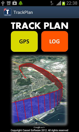
TrackPlan is a tracker application basically developed for aviators in mind, but can of course be used while driving all kind of vehicles with a great entertainment value.
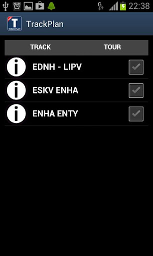
The basic idea is store fix points, coordinates, and generate so called KML files. KML (Keyhole Markup Language) files can contain tracks and tours. KML file can be viewed by Google Earth directly on the cell phone. TrackPlan can also send generated KML tours and tracks, via an inbuilt e-mail function, to be viewed on a PC/Mac/Linux or cell phones.
TrackPlan is very easy to use. Just a few click and you have recorded your tour. After landing, you can instantly view your tour in “3D”, send it to your friends and they can fly with you.
In order to view KML on your cell phone you need Google Earth, version 7.0 or newer, for Androids. Older version does not fully support KML. Google Play -> Google Earth
Most versions of Google Earth on PC/Max/Linux suppor KML tours.
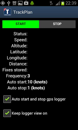
TrackPlan can be setup to start automatically, default and recommended setting. That means that logging will start when you pass a given speed during takeoff and stops when you speed is less than a given speed.
You will normally start TrackPlan during start up or run up and then just put the cell phone away but "visible" for satellite signals.
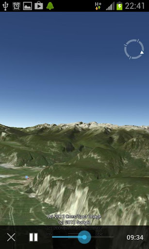
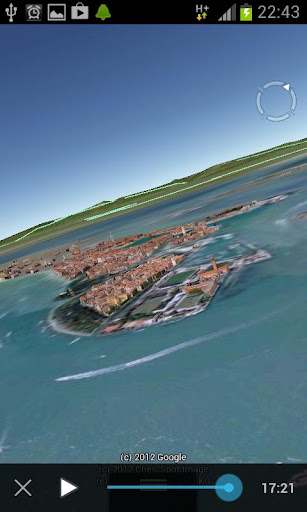
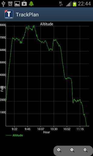
You will see that there are many different types KML files and diagrams that can be viewed. Different settings can be changed to satisfy your needs.
No need for more words. Just go ahead and play. Have fun
免費玩Track Plan APP玩免費
免費玩Track Plan App
Track Plan APP LOGO
Track Plan APP QRCode
| 熱門國家 | 系統支援 | 版本 | 費用 | APP評分 | 上架日期 | 更新日期 |
|---|---|---|---|---|---|---|
| 未知 | Android Google Play | 1.1 App下載 | NOK$0.0 | 1970-01-01 | 2015-03-07 |