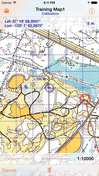
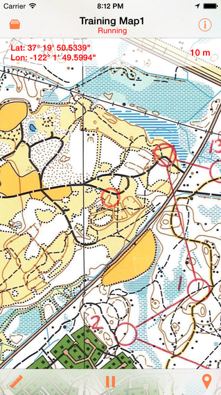
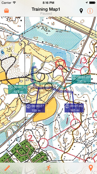
Orienteering Companion is an outdoor map utility for iPhone, which is primarily intended for orienteering training. The position of the user is displayed in real time on a map image that has been imported from the picture library and calibrated by the user. The app uses the Location Services in the device to get the current position information. The accuracy is at best +/- 5 meters, which requires a good GPS reception. Map images that have been imported are saved in a map collection. A new map image must be calibrated the first time before it can be used. After that, a calibrated map can be used unlimited number of times without any need for recalibration.Note:- Your use of this real time route guidance application is at your sole risk. Location data may not be accurate.- Continued use of GPS running in the background can dramatically decrease the battery life.- Maps are normally protected by copyright and the user must make sure to own the right to copy the images of the maps that are to be imported to the app.
免費玩Orienteering Companion APP玩免費
免費玩Orienteering Companion App
Orienteering Companion APP LOGO

Orienteering Companion APP QRCode
| 熱門國家 | 系統支援 | 版本 | 費用 | APP評分 | 上架日期 | 更新日期 |
|---|---|---|---|---|---|---|
| 未知 | iOS App Store | 2.0 App下載 | $5.99 | 2013-03-25 | 2015-06-03 |


