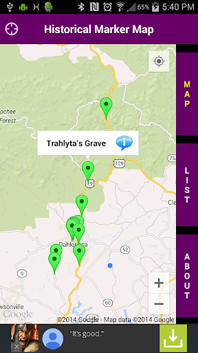
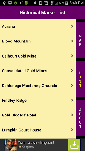
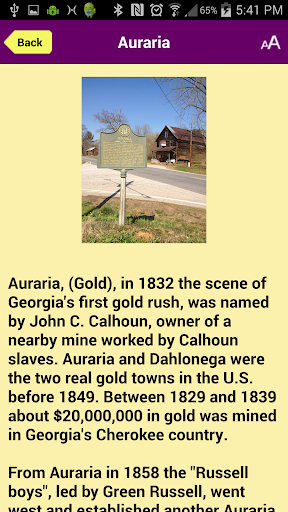
Historical Markers of Lumpkin County is an educational and informative app that is a useful tool for both historians and travelers of Lumpkin County, Georgia. The app features information on all of the Georgia Historical Markers currently erected in Lumpkin County, an hour’s drive north of Atlanta, Georgia. The historical markers are presented as both a list and via map for ease of use and flexibility. A photo and the complete text contents for each marker are displayed along with local written directions. Users can also touch the “Take Me There” button to navigate to a particular marker using their device’s built in GPS software.
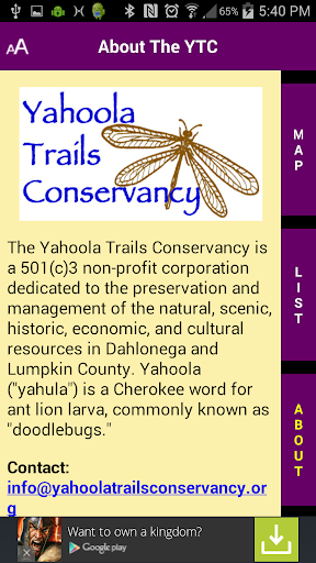
This app is presented by the Yahoola Trails Conservancy, a 501(c)3 non-profit corporation dedicated to the preservation and management of the natural, scenic, historic, economic, and cultural resources in the city of Dahlonega and in Lumpkin County, Georgia. More information about the YTC, including a membership application and other publications and maps are available via links in the app.
免費玩Lumpkin Co. Historical Markers APP玩免費
免費玩Lumpkin Co. Historical Markers App
Lumpkin Co. Historical Markers APP LOGO
Lumpkin Co. Historical Markers APP QRCode
| 熱門國家 | 系統支援 | 版本 | 費用 | APP評分 | 上架日期 | 更新日期 |
|---|---|---|---|---|---|---|
| 未知 | Android Google Play | 1.0 App下載 | 免費 | 1970-01-01 | 2015-04-24 |