*** New Release Campaign! 50% OFF NOW! ***
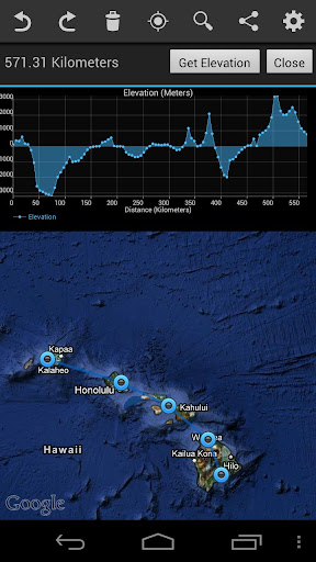
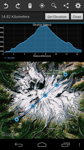
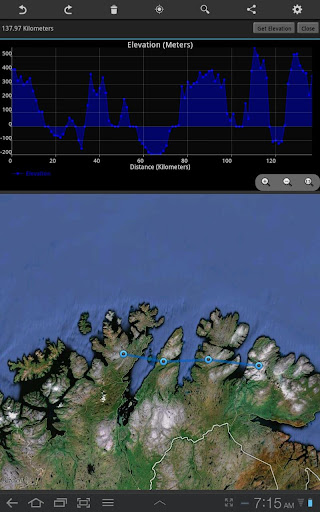
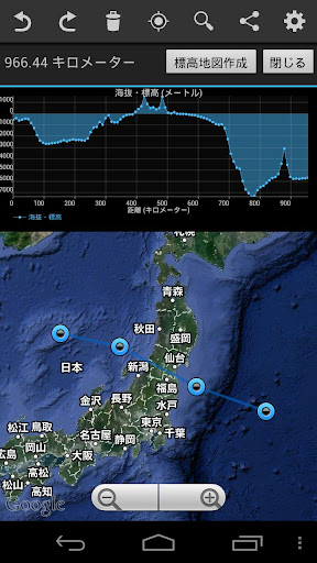
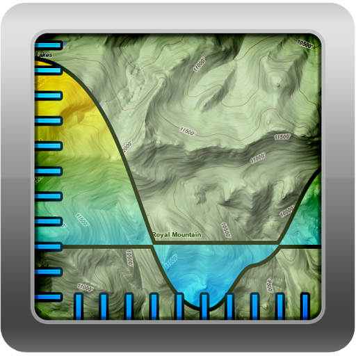
Geo Elevation is a powerful tool to build a cross-sectional elevation chart from any paths/points on the map with a few clicks. Simply create a path and click on "Get Elevation" you will see a nice chart.
How does Mt. Everest look like if you cut through the peak, and view it from the side? Try to draw a path from your place to the nearest shoreline. See how slope decline as it approach the ocean? How about investigating the Mariana Trench's steep slope, which goes down to the deepest place on the Earth?
In addition, the line of the elevation profile is clickable to indicate corresponding location on the path that you draw.
(Update)
Now, this app works on both phone and tablet! Buy only once, and enjoy in both platform. We definitely recommend you to try it on a tablet device.
[Features]
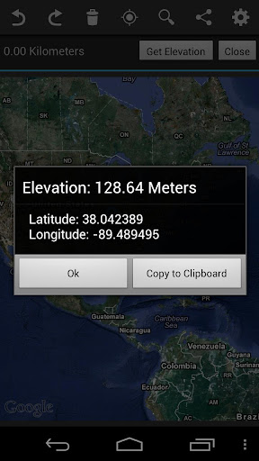
- Get Elevation from single point
- Get Elevation from a path
- Path will automatically allocate 100 points (really high-definition of elevation profiles!)
- Export cross-sectional chart in image format (PNG)
- Export raw data in CSV format
- Export the path in KML
- Export the summary text
- Single-click to various formats
- High-Res display compatible
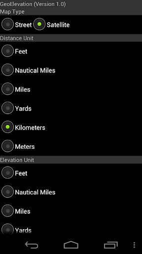
- Customized UI for all android devices
- Multi-touch in the chart screen
- Current Location On/Off
- Draggable Waypoints (Adjust the path later)
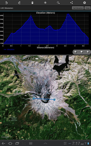
- Instant calculation of the distance
- State of art intuitive path draw tool
- Flexible layout for any screen slize
- Unlimited Undo / Redo
- Convenient "Clear All" button to reset
- Intuitive Navigation Interface
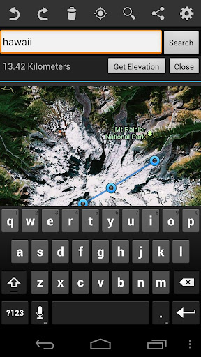
- Search location to zoom the target area quickly
[Usage]
- As a bike / running route builder: It's convenient to research your bike road profile in order to figure out the schematics of hills.
- Mobile Learning Experience in the Classroom. If you are teaching Geology or Earth Science, you might have a handout to build a cross-sectional elevation chart from a contour map, and you can let students to verify their answer by themselves. Don't forget, Geo Elevation will provide infinite locations to investigate! The usage is unlimited.
- Possible flood area investigation: Before storm surge or high tide hit your town, verify locations or road that could be flooded. Draw the path from your house to the nearest shoreline to see the vertical profile.
- Plan your Walk or Run: If you host a walk or run event, Geo Elevation will help you to find out the slope so that you can map challenging hill in your event. Additionally, it might help you to setup multiple routs depend of the slope.
- For hiker and mountaineers (send us your review if you used for your activities!)
Add your feedback in comments or send us email to android [-at-] objectgraph.com.
We would like to hear more user experiences! How did you use it? What did you use it for? Is there anything to improve?
[User's Review]
"Amazing and so quick!" by IGP
Leave a comment here!
免費玩Geo Elevation: Generate Chart APP玩免費
免費玩Geo Elevation: Generate Chart App
Geo Elevation: Generate Chart APP LOGO
Geo Elevation: Generate Chart APP QRCode
| 熱門國家 | 系統支援 | 版本 | 費用 | APP評分 | 上架日期 | 更新日期 |
|---|---|---|---|---|---|---|
| 未知 | Android Google Play | 2.0 App下載 | USD$1.99 | 1970-01-01 | 2015-04-23 |