This was built to determine acerage burnt during wildland fires. Can also be used to get a size up of the fire and email a map, current weather conditions, and GPS of the fire, to anyone the user chooses. Built for fire departments to get a ballpark figure of the size of fires.
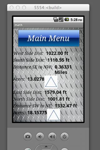
The area is calculated using 4 corners of the fire. It calculates in 2 triangles to account for odd shaped fires.
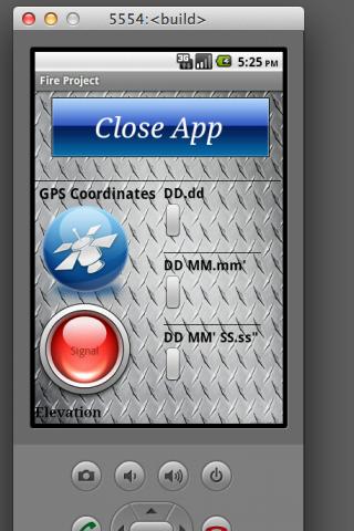
GPS I also included three GPS formats. I found that everyone wants something different. So all are there for display.
This app uses the gps on the phone so ensure to close the app using the close app button to ensure that the gps turns off.
It pulls the nearest weather station and forecast for 3 days.
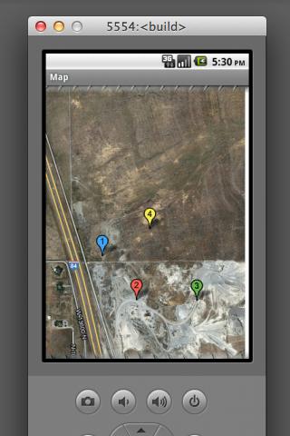
It also has the ability to share waypoints from person to person. So one person doesn't need to get all of the corners of the fires. Someone with the same app could get the other side of the fire and send them to you. As long as you both have the same fire name(case sensitive)
This was not written to figure exact size. Fires don't burn in squares or triangles. So this only gives a ballpark figure as the crow flies. I have compared the results with other sources and found to get the same numbers when comparing equal sized areas.
免費玩Fire Project APP玩免費
免費玩Fire Project App
Fire Project APP LOGO
Fire Project APP QRCode
| 熱門國家 | 系統支援 | 版本 | 費用 | APP評分 | 上架日期 | 更新日期 |
|---|---|---|---|---|---|---|
| 未知 | Android Google Play | 12.0 App下載 | USD$0.99 | 1970-01-01 | 2015-01-15 |