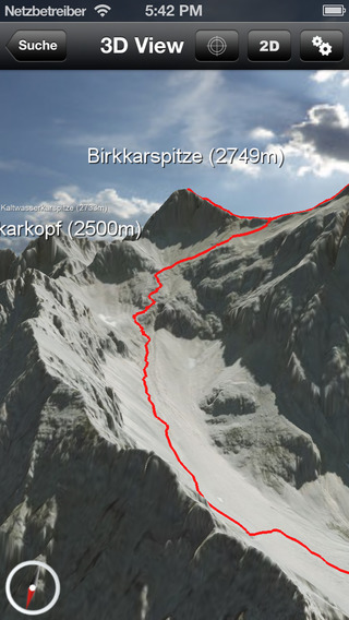
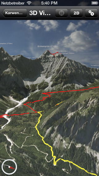
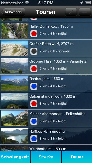
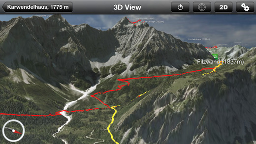
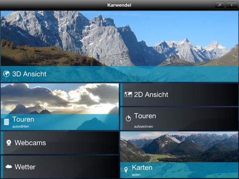
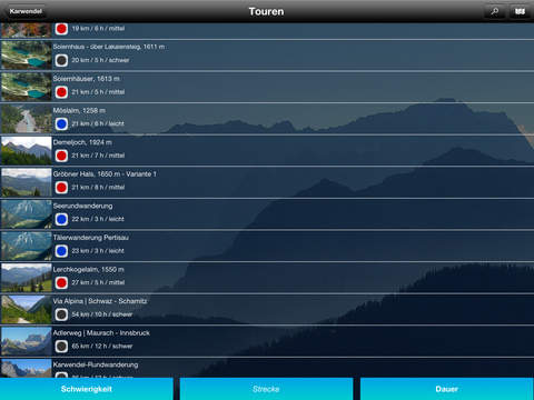
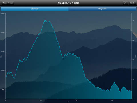
The app allows you easy and safe navigation in the mountains. The unique photorealistic 3D map view helps to prepare a tour, en route you always know where you are and after the tour you can analyze a detailed recording of your outdoor adventure. Whether hiking, climbing or mountain biking, with the 3D outdoor navigation app you are always well prepared.The unique realism of the 3D maps comes from very high resolution aerial images and a very detailed digital terrain. The photorealistic representation of the landscape helps you in better planning your next mountain adventure. On the way the 3D map view together with the GPS greatly improves orientation and navigation. After your trip you can analyze the highly accurate GPS track or share it with your friends.All tours and geographic information are accurately located. Your current position is recorded by GPS and shown in the 3D map view. This greatly facilitates orientation and navigation and together with the detailed geographical database you always know exactly what is around you. With each map up to 50 tours are included that were selected by mountaineering experts, each with detailed description, height profile and GPS track.Offline use: load the 3D map on your smartphone and all information will be available without a mobile connection.Features at a glance:- Highly realistic 3D representation of the landscape based on aerial photographs- Better preparation and safe and easy orientation even in poor weather conditions- Extensive geographic information for orientation on site- Up to 50 tours each with track display, description and height profiles - Display of own position in 3D map using GPS- Automatic alignment in the direction of motion- Accurate recording of tours details and statistics such as speed, altitude, distance traveled and duration.- 3D map download for continuous availability without mobile connection More than 80 maps are available. Please check the coverage at outdoor-guides.de- Summer: Achensee-Rofan, Allgäuer Alpen, Alta Badia, Arlberg-Paznauntal, Berchtesgadener Alpen, Bodensee-Rätikon, Brandnertal-Walsertal, Bregenzerwald, Chiemgauer Alpen, Cortina d'Ampezzo, Eggental-Latemar, Fassatal, Isarwinkel, Karwendel, Kaunertal-Oberinntal, Kitzbühler Alpen, Königswinkel, Lechtal, Montafon, Ötztaler Alpen, Pitztal, Rosengarten-Seiseralm, Rund um Innsbruck, Seefeld-Imst, Sextener Dolomiten, Stubaital, Tegernseer und Schlierseer Berge, Wilder Kaiser, Wipptal, Zillertal, Zugspitze & Ammergauer AlpenTry any of these maps for free for a period of two weeks. If you want to use a map permanently you need to purchase it as in-app. Prices ange from 6,99 – 9,99 €.Remark: Continued use of the GPS can dramatically decrease battery life. Only for iPhone 4s and more recent models. Optimized for iPhone 5 and 6.


免費玩3D outdoor guides APP玩免費
免費玩3D outdoor guides App
3D outdoor guides APP LOGO
3D outdoor guides APP QRCode
| 熱門國家 | 系統支援 | 版本 | 費用 | APP評分 | 上架日期 | 更新日期 |
|---|---|---|---|---|---|---|
| 未知 | iOS App Store | 1.7.12988 App下載 | 免費 | 2013-07-18 | 2015-05-30 | |
| 美國 (U.S.A) | iOS App Store | 1.7.10053 App下載 | 免費 | 2014-08-28 | 2014-09-26 |